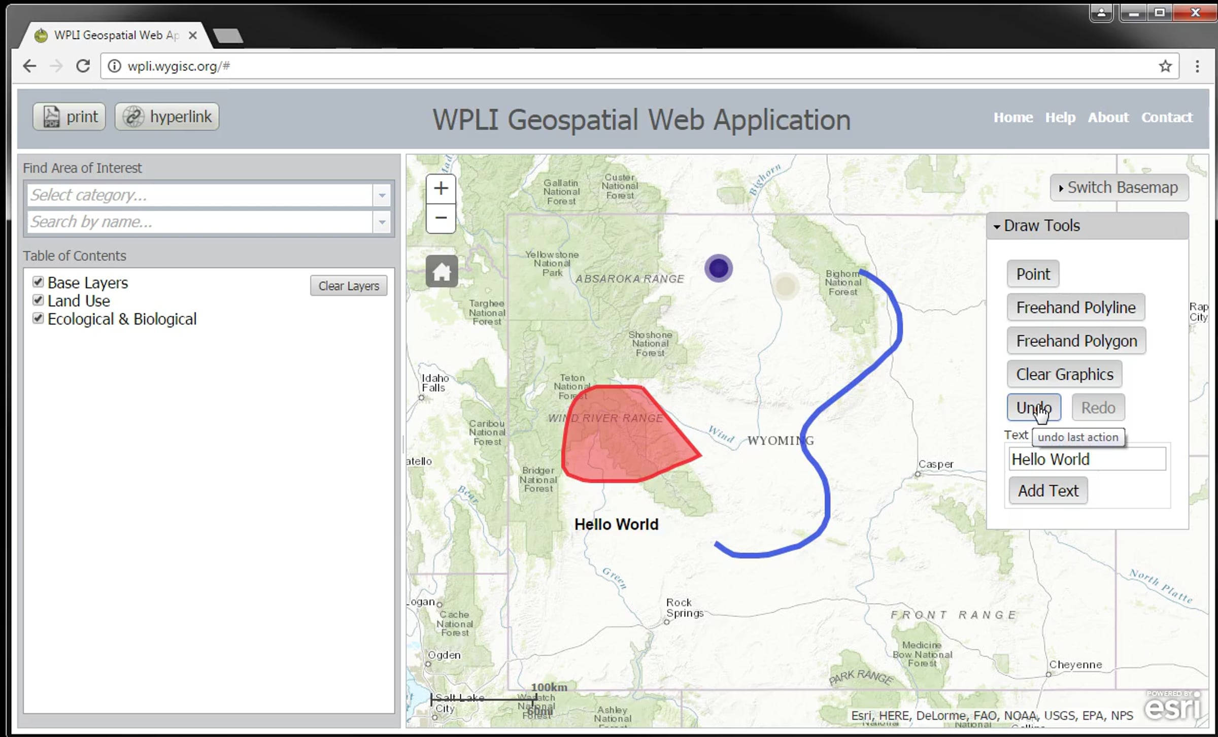
WPLI Tutorial 4: Draw and Annotate

This is a turorial video for the Wyoming Public Land Initiative Geospatial Web Application. This video covers drawing and annotation tools.
Get started for free
24/7 customer support
Our customer support team is available to help 24/7. Enterprise members also receive dedicated account managers and a guaranteed uptime SLA.
© 2026 Vimeo.com, Inc. All rights reserved.
TermsPrivacyYour Privacy ChoicesU.S State PrivacyCopyrightCookies