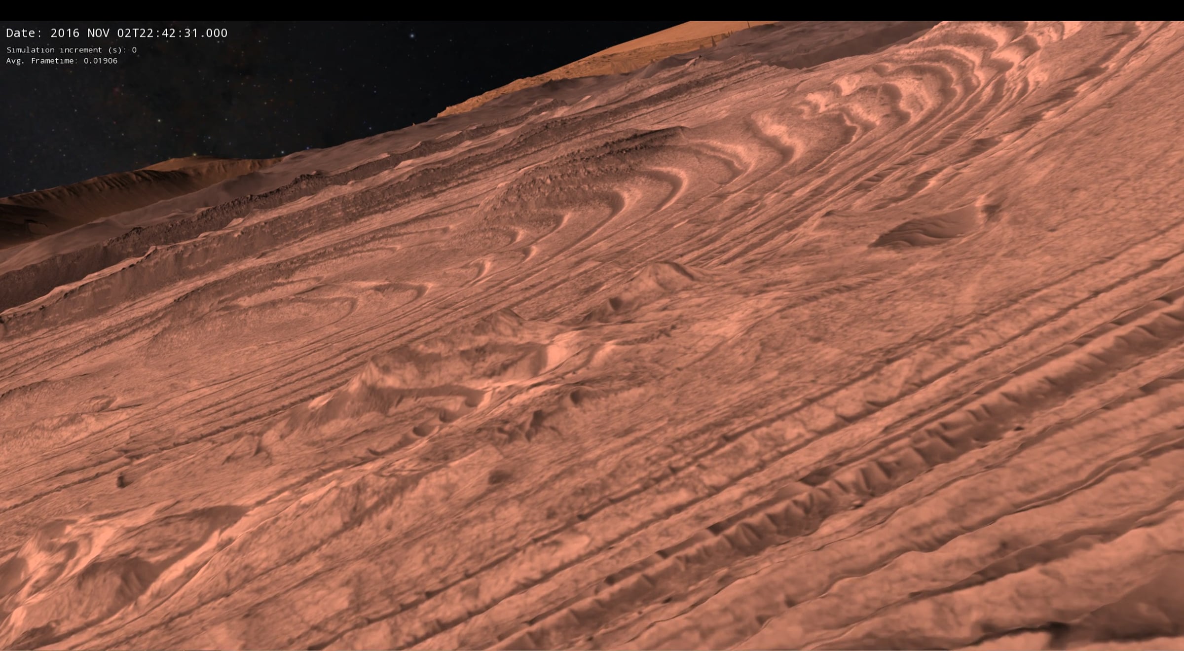
Mars: Western Candor Chasm, Ceti Mensa

Orbital mapping from three different missions are combined here and recorded live from interactive flight with OpenSpace, NASA supported open-source software (openspaceproject.com). NASA's Viking mission reached Mars in 1976 and eventually built up a global color map of Mars, which we use to colorize a monochromatic Mars Reconnaissance Orbiter (2006-current) CTX (6 m resolution) 75% global mosaic, and HiRISE (0.25 m resolution) imagery of this wind eroded layered terrain. The Mars Global Surveyor (1997-2006) mission measured a global height map with the Mars Orbiter Laser Altimeter (MOLA) which we locally enhance by processing stereo CTX imagery using the NASA Ames Stereo Pipeline (done by Bergen Country Academies High School students), putting that together with HiRISE terrain also from stereo imaging (conducted by the USGS). No atmosphere is shown hear as it is under development as of this posting. Stay tuned...
Get started for free
24/7 customer support
Our customer support team is available to help 24/7. Enterprise members also receive dedicated account managers and a guaranteed uptime SLA.
© 2026 Vimeo.com, Inc. All rights reserved.
TermsPrivacyYour Privacy ChoicesU.S State PrivacyCopyrightCookies