LightOnEurope

Explore Europe By Drawing
Check:
https://bufferclip.github.io/lightoneurope-website/
https://twitter.com/LightOnEU
Data Sources:
Population:
GEOSTAT 2011 grid dataset
European Commission (Eurostat, Joint Research Centre and DG Regional Policy - REGIO-GIS)
http://ec.europa.eu
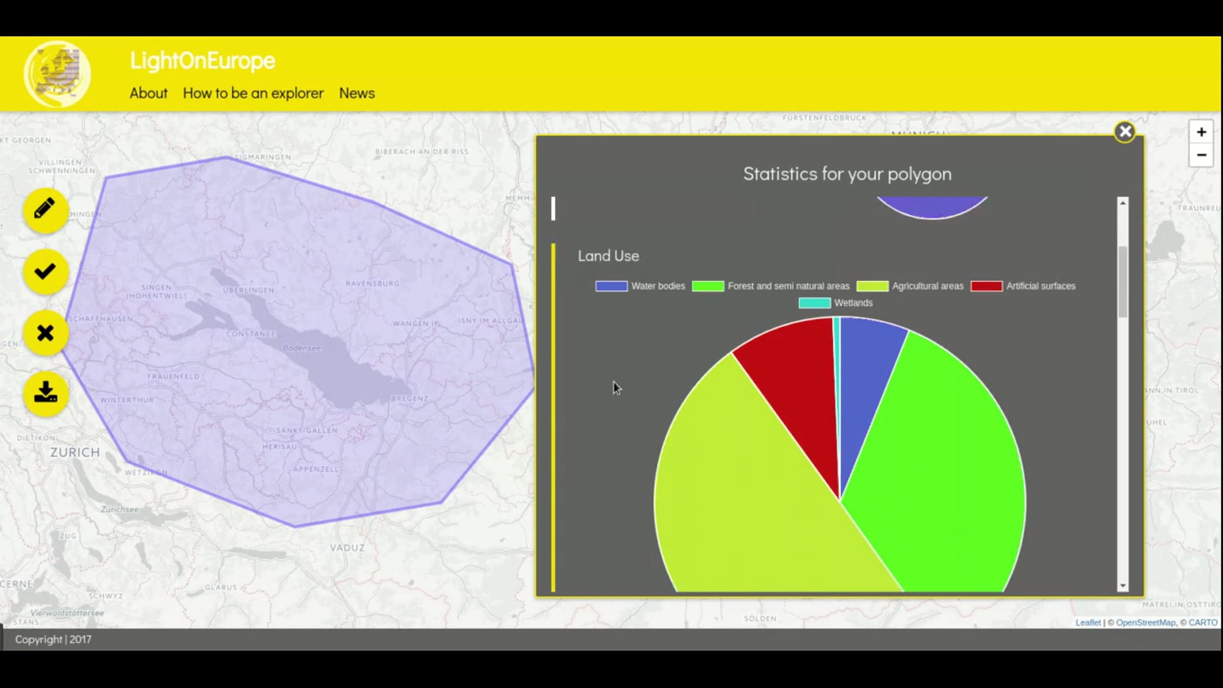
Landcover:
CORINE Land cover. Contains modified copernicus data 2017.
Produced by EEA with funds from the EC.
https://www.eea.europa.eu/legal/copyright
http://land.copernicus.eu/pan-european/corine-land-cover
Temperature:
WorldClim 1.4 (current conditions) by www.worldclim.org;
Hijmans et al., 2005. Int. J. of Clim. 25: 1965-1978.
is licensed under a Creative Commons Attribution-ShareAlike 4.0 International License.
Mountains:
© OpenStreetMap Contributors
Basemap:
© OpenStreetMap, © CARTO
Probar gratis
Atención al cliente 24x7
Nuestro equipo de asistencia al cliente está disponible las 24 horas, los 7 días de la semana. Los miembros Enterprise también reciben gerentes de cuenta especializados y un SLA de tiempo de actividad garantizado.
© 2026 Vimeo.com, Inc. Todos los derechos reservados.
TermsPrivacyTus opciones de privacidadU.S State PrivacyCopyrightCookies