Mt. Baker Circumnavigation (easy version) 2016

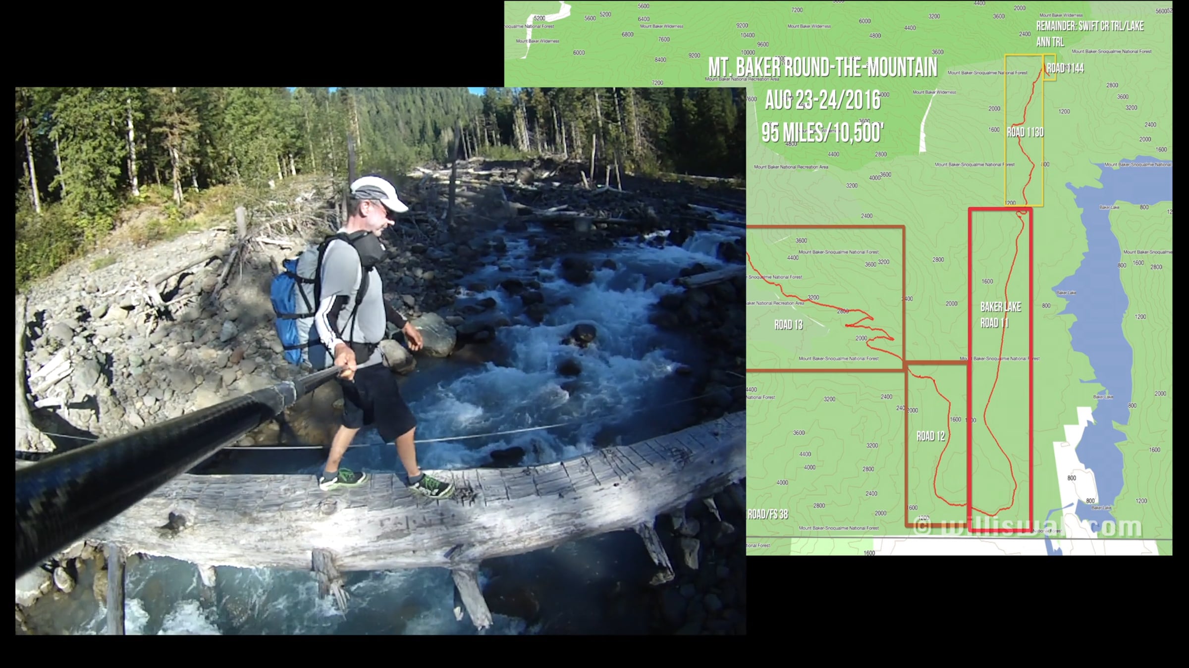
Back in 2016 I concocted a relatively easy way to circumnavigate Mt. Baker, bypassing some difficult cross country on the west side by biking from the Lake Ann trail head on Highway 542 westward, looping back towards the mountain on Mosquito Lake Road and FS Road 38 to the Ridley Creek trail head. The rest of the trek was on trail or road. From my research a duo had accomplished a circumnavigation years earlier, taking 25 days with some serious physical toll.
Kudos to Jeff List, who completed a circumnavigation in June 2020 without resorting to bike or skis, in 38 hours no less. I’m sure more people will join in now that it’s been done a few times. But for those who do not have the cross country skills or serious ultra training (or both), utilizing the bike portion and my itinerary can be done by just about anyone.
I resurrected the video I had recorded on my trip and authored this 15 minute piece. I used a Contour Roam2 camera, easily attached to my bike and my trekking staff and very compact in size. Unfortunately I lost the mount on my pole during the latter portion of my trek on the Swift Creek trail, but luckily the camera was in my pocket at the time. My trip totaled 95 miles (58 biking) and a bit over 10,000 feet of elevation gain. Contrast this to Jeff’s trek which he put at 71.6 miles and 22,753’ of vertical gain. I mention it in my video, but anyone who is in excellent running shape could probably do my version of this trip in a day. In 2016 it had been over 15 years since I had run an ultra so I walked the 22 miles of hiking.
Get started for free
24/7 customer support
Our customer support team is available to help 24/7. Enterprise members also receive dedicated account managers and a guaranteed uptime SLA.
© 2026 Vimeo.com, Inc. All rights reserved.
TermsPrivacyYour Privacy ChoicesU.S State PrivacyCopyrightCookies