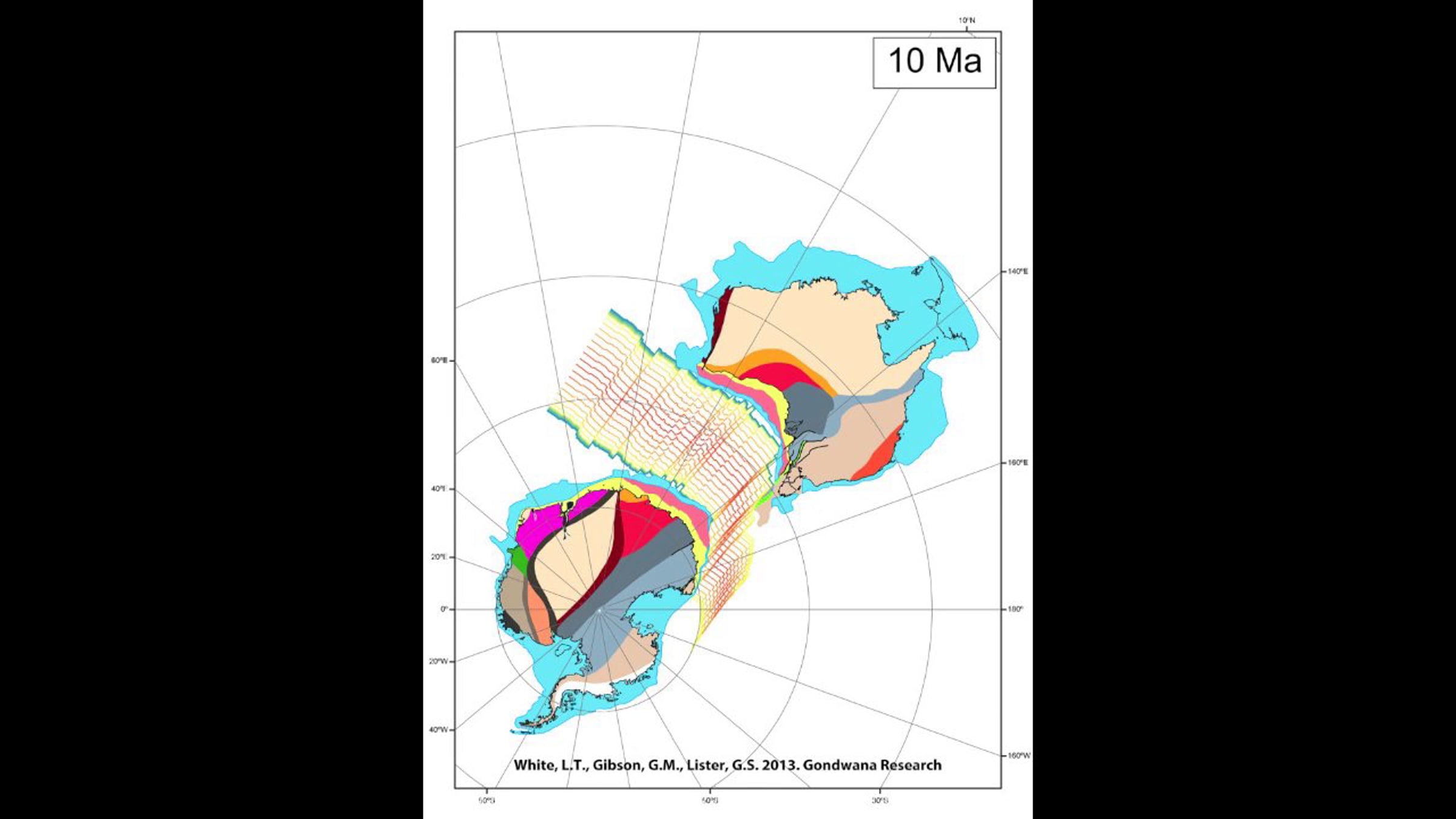
Australia-Antarctica-India Breakup

This video shows a reconstruction of the breakup of the Australian, Antarctic and Indian tectonic plates, demonstrating how the major plates that once formed eastern Gondwana broke apart, starting from 165 millions years ago and progressing to the present day.
The coloured polygons represent different geological units that have been mapped (and inferred) by geologists over many years. These geological units formed before the continents broke apart, so we can use their position to put the "jigsaw pieces" back together again. Many other reconstructions do not use the geological boundaries to match the continental "jigsaw pieces" back together - so they don't align properly. This is discussed in detail in a scientific paper titled: "A reassessment of paleogeographic reconstructions of eastern Gondwana: bringing geology back into the equation" which is published in the journal "Gondwana Research" and can be accessed here: (http://www.sciencedirect.com/science/article/pii/S1342937X1300213X).
Please also note that Australia and India are rotated with respect to an arbitrarily fixed Antarctica, this is why Antarctica does not move in this animation.
A lower quality version of the movie can be downloaded on Vimeo, otherwise a higher quality version is available here (https://www.researchgate.net/publication/245031383_Tectonic_Reconstruction_of_Australia-Antarctica-India_Breakup?ev=prf_pub).
Get started for free
24/7 customer support
Our customer support team is available to help 24/7. Enterprise members also receive dedicated account managers and a guaranteed uptime SLA.
© 2026 Vimeo.com, Inc. All rights reserved.
TermsPrivacyYour Privacy ChoicesU.S State PrivacyCopyrightCookies